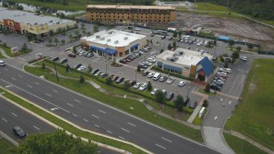
Professional drone services company specializing in aerial mapping & data collection, orthophotography, construction progress photos and video, aerial photography, aerial video, video editing services, and residential / commercial real estate video tours. Servicing the Orlando and Central Florida area. We utilize the latest drone and camera technology to produce a superior digital product.
This page uses Google Maps. The map will be loaded from Google-Server and some of your data may be used by Google. In order to see the maps, please click accept. You can also click here to see further information related to this.
BUSINESS REVIEWS
0.0
based on 0 Reviews
5 Star
0
4 Star
0
3 Star
0
2 Star
0
1 Star
0
There are no reviews at the moment
{picture_link}
{picture_path}
Image resizing
To resize your image simply use the scroll wheel on your mouse and adjust accordingly.


Cynosure Aerial